Monday, July 1, 2013

Relaxing at Coal Creek Camp


Brian and Rachel strike a pose in front of our transportation for the day on the Eagle airstrip. After only one day off in the town of Eagle we were flown about 50 miles into the park to Coal Creek Camp. A remote residence camp for National Park Employees, Coal Creek Camp is closer to our next work location which we would travel to using boats on the Yukon River.


Flying over the town itself I was able to get a nice view of the locality and its namesake bluff looming in the background. All the abandoned buildings and old vehicle remnants make the town appear much larger from above. It was pleasant staying the small town, but we were off to an even more isolated living situation.


We flew over many of the scenic tributaries which wind their way across tundras and past mountains before pouring their contents into the Yukon.


I snapped this photo as the pilot swung us around for our final descent. Coal Creek Camp stands out among the expanses of trees, rock, and water. Miles from anything, this was certainly going to be a remote time off.


Above is the main building at the camp. It houses a few storage rooms, an open kitchen, a mess hall with a few tables and the laptop I am using right now (ironic how the best internet access I have gotten so far in Alaska is the farthest from civilization). There is also a small room with an old TV and a bunch of VHS tapes (an strangely high number of which are Mel Gibson films).


A few cabins stand in a row. Inside are just a few mattresses and a wood burning stove. Pretty spartan place for our time off, but we welcome the solitude and are never bored of spending time in the woods. 


The three of us are the only ones at the camp, so we spend our days leisurely. Aside from playing innumerable games of cribbage and scrabble, I enjoyed strolling down to the nearby creek where three beavers were tirelessly toiling on their rather impressive dam.


It was entertaining to watch these funny animals as the seemed to just to build for the sake of building more...sounds like another animal I know. It seemed as though they really could benefit from having opposable thumbs.


A little creek that trickled by the side of the camp.


Brian and I played basketball in the dry heat (in the 80s!) using a rim nailed into a tin shed that must have been at least 50 years old. The camp was originally a mining camp back around the turn of the 19th century. As the gold ran out, and the miners' luck with it, the camp slowly transitioned into park service land which is how it is used now. Gold can still be found in the streams nearby (one of the maintenance guys who helped drop us off actually panned some out for me), but it is all tiny little specks not worth the time, effort, or environmental destruction, to actually collect.

Thursday, June 27, 2013

Funnel Creek: 10 Days in the Wilderness

My first ten days in the wilderness on assignment were beyond incredible. Everything....the people I was with, the landscapes, the work, and the wildlife were amazing. Below is a glimpse of what I experienced the past ten days out in the bush.


The first part of the trip consisted of my first ever helicopter ride. A small helicopter ended up having to make two runs in order to get the three members of our crew and all our surveying gear out to the bush. This provided me with the chance to get a great spot against one of the bubble windows. If you have never been on a helicopter before it is something that is rather difficult to describe. All your senses expect the aircraft to function as an airplane....but then it takes off straight upwards.


A few aerial shots I got during our ride. The freedom of the helicopter also allowed the pilot to strafe subalpine meadows, wind through canyons below the ridgeline, and even enter Canada for minute by accident!


The mighty Yukon River winds its way through Yukon Charley Rivers National Preserve with Montauk Bluff in the background.


Cutting through one of the many super steep and rocky drainages I caught this picture. If you look very closely you can spot a Dall sheep ram about halfway down the thin gravel slope in the middle of the photo.


Brian Howard, one of my fellow crew members, and myself were flown out first as our team leader, Fleur, had not arrived in Eagle from Fairbanks via single-prop plane. Brian and I pointed out the saddle between the two ridges on which we had planned to camp and within a minute our pilot had set us down. No taxiing, no waiting to unload, or circling in the air...just going wherever we wanted to. The moment it really hit me that I was out in the Alaskan wilderness was after we had unloaded our gear and the pilot hopped back in the heli and disappeared down the valley.


From only about 50 feet past our campsite there was a nice view of the large drainage in which almost all of our work for the next 10 days would occur. The slope on the right leads up to Nimrod Peak, and the slope on the left leads up to Squaw Mountain. I cannot stress enough how difficult this topography made our work both physically and mentally.


This photo is from about halfway up towards the ridge along Nimrod Peak where we had to put in temperature sensors. The steepness of the slopes (commonly between 40-45 degrees), looseness of the rocks, thickness of brush, heat, mosquitos, and heft of our packs (40-50lbs each) made hiking between plots unbelievable tiring. To reach some plots a mere 500m away it could take over an hour. This made for some very long days where we would hike out at 8 in the morning and return past 9 in the evening.


On a blustery, and particularly exhausting, day I snapped this photo of the Yukon River in the background between thunderheads and sunny skies...typical Alaska.


Fleur and Brian analyze the placement of a soil temperature gauge placed along part of the Squaw Mountain ridge.


A view back along the Squaw ridge. With really only one day exception, the weather the entire trip was magnificent, if not a little warm.


The slopes were dominated by gigantic spires of rock which gave a spectacularly forlorn, yet beautiful, appearance to many of the areas we hiked.


Following the ridge one day down Squaw Mountain we spotted a grizzly bear (brown, mid-left) wander out onto the plateau we had planned on using to reach our next plot. As Brian put it, it was a "wilderness traffic jam" as we stopped for an early lunch and waited for the bear to exit the immediate area. Before doing so though a second bear (black bear, upper right) also emerged and prolonged our continuance down the slope. Once they both had sauntered over to the left margins of the bluff we were able to continue on our way.


The skies at midnight...that's right. Nothing like waking up at 3:30 in the morning to the sun blaring into your tent.


On the way back one evening from work Brian spotted a few morrells which we sauteed up for dinner. Tasty mushrooms with a nutty flavor/aroma, my first time trying them.


Curious bumblebees flitted between flowers almost everywhere we hiked which was a pleasant sight having come up from the lower 48 where their disappearance has lowered the chance of spotting one.


Nameless, hundred foot cliffs would come out of nowhere. Definitely got that feeling of vertigo standing on their edge sometimes. One cliff in particular sticks out in mind, I didn't have my camera with me, but about 10 hours into the work day we were all tired and trying to figure out the best way back to camp (a good 2 hour hike away). We first tried to descend a ridge into the Funnel Creek drainage but a sudden, and dramatic, 300 foot cliff popped out of nowhere and forced us to retrace our steps.


Brian gets a good view of the Harrison Creek watershed and Jones Ridge from a cliff top.


A view towards Harrison Creek.


Fascinating fossils were unbelievably abundant on some slopes. Our last evening we went for a stroll, and on one rock face it seemed as if every pebble, rock, and boulder had at least one fossil.


The last morning as we packed our gear up waiting for the helicopter to arrive around noon I was speaking to Fleur when I noticed movement over her shoulder. I got quite the shock when I realized it was a monstrous grizzly bear that was wandering down a sheep trail directly towards our camp. As we observed the bear, it turned and disappeared down the slope towards the Funnel Creek valley. We thought it was gone...

 About fifteen minutes later however I spotted movement only ~30 yards from camp. The gigantic animal had somehow snuck over the ridge without anyone noticing. We made sure our presence was clear to the bear as it meandered through the thick brush, often only the recognizable grizzly shoulder hump visible above the shrubs. Then it took a sniff of the air and stood on its hind legs to look at us. I froze at that moment, and did not take a picture. But the sensations I felt the instant the grizzly bear stood on its hind legs and looked directly at me can hardly be described in words or photos, but undoubtedly left an impression in my mind. I gathered myself quickly and grabbed this shot as he turned and before he fell back to all fours. Within seconds he had run off to the spruce stand in the background. A truly magnificent encounter, and magical way to end my first 10 day trip to the Yukon.


Friday, June 14, 2013

A Mini Tour of Alaska: Central, Fairbanks, Denali, and Eagle

The past week I have logged quite a lot of miles around the interior of Alaska as our botany crew attempts to stay on schedule. Last week, on Tuesday, we finally pulled out of the NPS Headquarters in Fairbanks heading to the small town of Circle north (it is said that the founders of Circle gave it its name because they thought they had reached the Arctic Circle...turns out they were 50 miles south). Our two crews of three members each drove two big trucks hauling along flat-bottomed motorboats. The plan was to boat ~60 miles up the Yukon River into the Yukon Charley National Preserve to access our botany work plots.


The day was spent travelling in some rather isolated country (above in what we believe are the White Mountains) and ended in the town of Central, AK. Much to our dismay, we were unable to make it to Circle due to a river that had washed out the road only 7 miles short of our destination.


After hours of slow and tiresome driving this is the sign that met us. After using a SAT phone to reach our supervisor back at Fairbanks, we turned right around and made the trek back. Our crew was then shipped back down to Denali National Park (oh, bummer) where continued doing training and practice plots while we waited.


Our view during lunch on one of our training plots near Sanctuary River in Denali. Reaching this point required quite a lot of intense bushwacking through thick dwarf birch shrubs and alder stands. We also passed a grazing moose along the way.


One of our crew members, Eric, "botanizes" during our lunch break.

Due to long travel days combined with drawn out work periods, our last day in Denali we were let out a little early and given the chance to hike the Triple Lakes trail. The trail picks up outside the park near the town of McKinley Village and ends ~8 miles later by the visitors center (one of very few trails in Denali, basically all located in the visitors center area).


The Triple Lakes trail winding its way towards the Alaskan Range.


The first of the three lakes passed had a large beaver lodge on the near bank. No beavers were seen however.


The trail climbed and climbed to the top of the ridge that separated park from non-park land. The three lakes looked majestic far below.


Stands of Quaking Aspen made the hike all the more wonderful.


Brian Howard, a member of my crew, almost walked right into this prickly fellow. By the time I got my camera out he had wandered down away from the trail. The porcupine then proceeded to climb a nearby tree which was amusing as he sauntered about just about as fast and worried as you would expect an animal covered in gigantic quills.


This past Wednesday, back in Fairbanks from Denali, and fueled with lots of coffee, Brian (the seasonal botanist in my crew), Rachel (the other SCA intern, working for the other crew), and myself drove to the town of Eagle. The 8 hour drive was mostly due to the conditions faced on the Taylor "Highway". This road (almost all dirt/gravel) was 160 miles long and dead-ends in Eagle. Usually unable to go more than 30-35 miles an hour, the wonderful scenic views made for a doable trip. Also, we had the privilege of passing such well known metropolises such as Tok and Chicken (rumor has it the town is called Chicken because the miners who founded it didn't know how to spell Ptarmigan). Both of these towns could have been mistaken for a small rural rest stop.


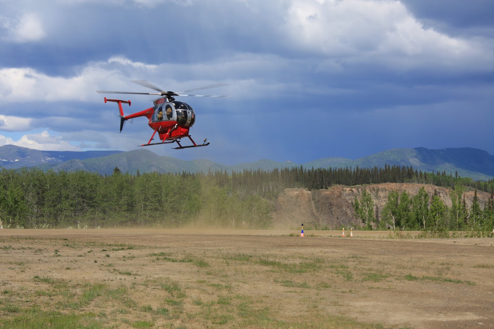
Finally in Eagle, we were given a warm welcome and tour around the area by one of the NPS rangers living there. We drove out to the airfield to learn how to access gas for our rig, and while we were there a archaeology crew flew in from the preserve giving us a little taste of what is to come on Monday.


Dubbed the Hilltop House, our living situation consists of more or less a double-wide trailer, non-potable water, and a non-functioning shower. Not that any of that matters seeing as we will be living in the wilderness in just a few days. On the right is the massive F-350 truck we had to use (we actually filled it) to get to Eagle. Quite the beast.


Our first evening we meandered down to the visitors center and among the aspens along the Yukon River.


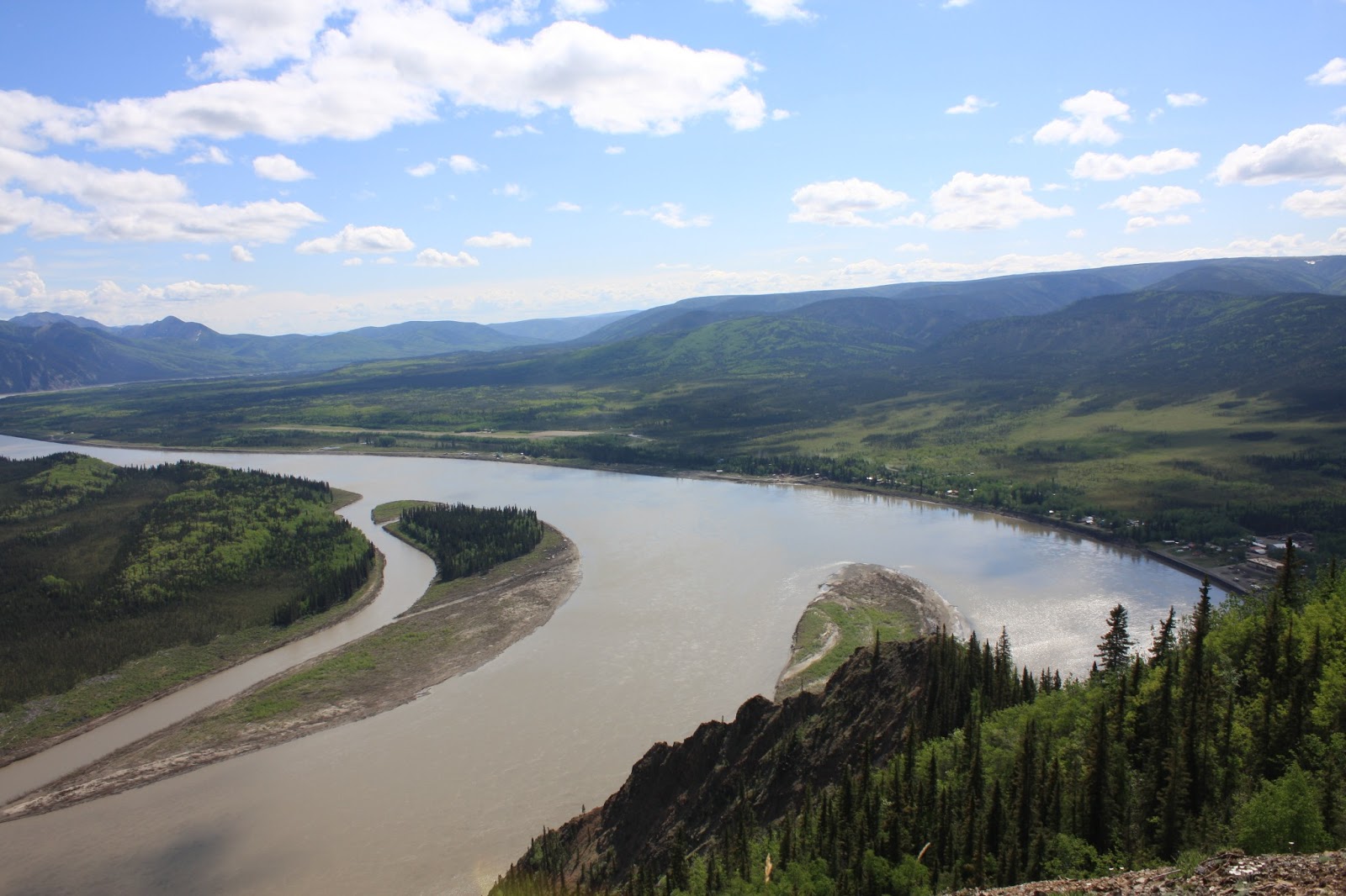
The town is beautifully located on the banks of the mighty Yukon on a particularly wide bend. Yukon Charley Rivers National Preserve beckons in the distance.


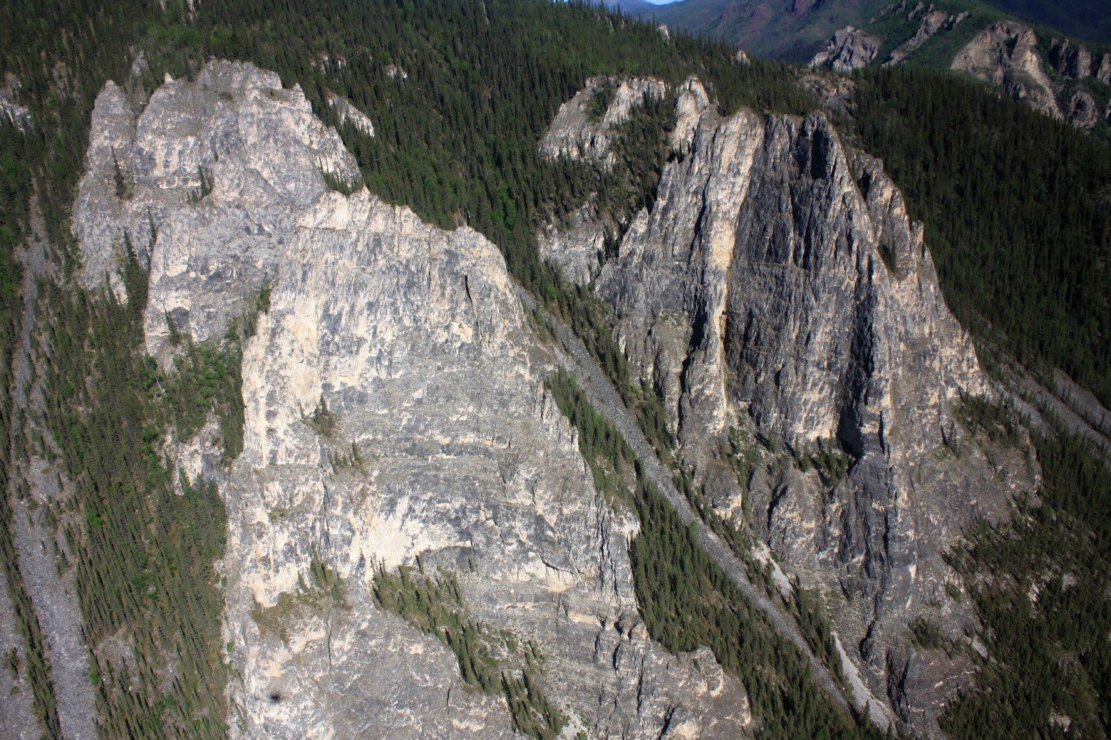
Eagle Bluff looms over the town and pierces out into the silt laden river.


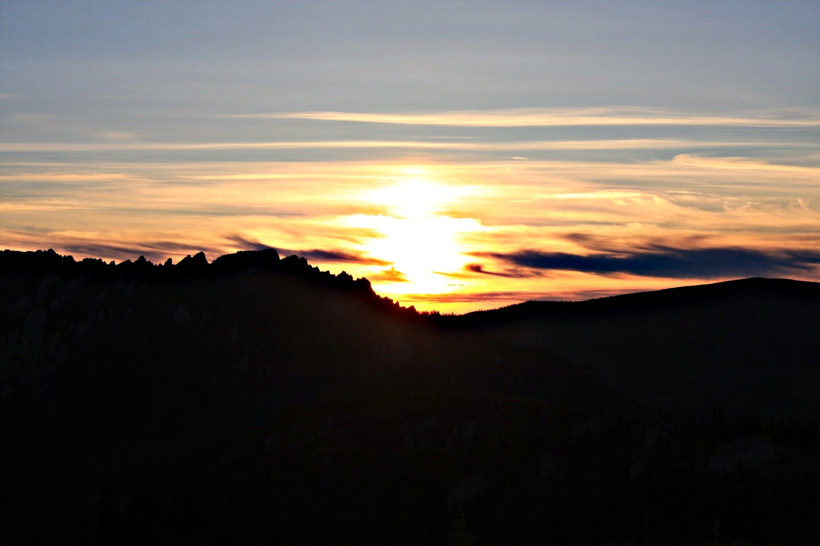
The small town basks in the late evening sun. Everyone around town recognized us immediately as outsiders and seemed friendly, welcoming us to the area.


Yesterday, after a relaxing morning, we decided to try to climb Eagle Bluff. First we had to cross the uber-cold Mission Creek.


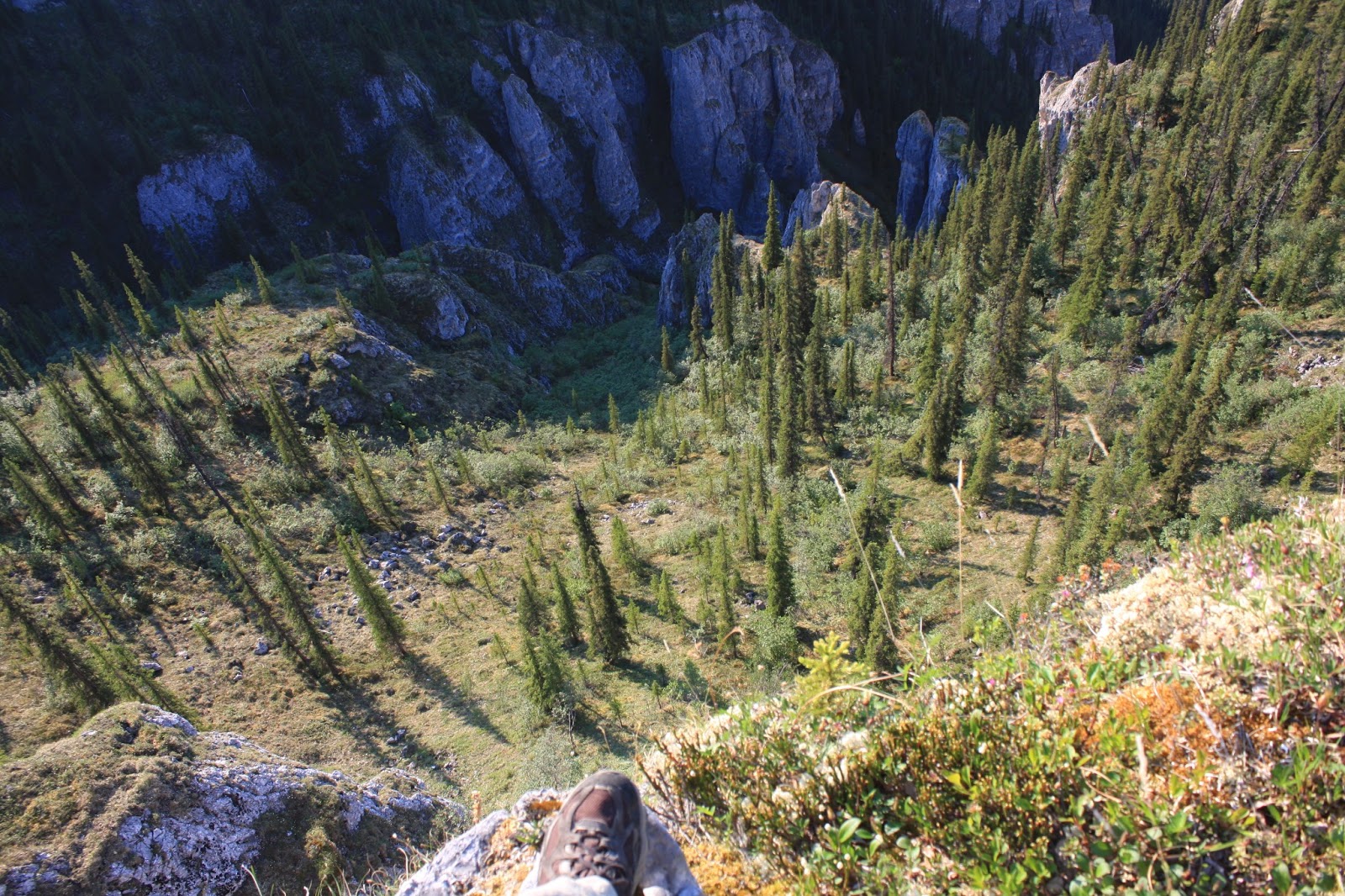
After a very tough climb bushwacking through dense undergrowth of spiny herbaceous plants we popped out on top only to find we had over shot Eagle Bluff by almost twice its height. Whoops, at least we had an awesome place to eat lunch.


The river was like a gigantic living organism...its fast current and rippling silty water made it come alive.


Two resident rams on the bluff seemed surprised to find us...especially as we were above them. Dall Sheep are interesting in that, except for times of mating, the sheep roam the steep slopes in either groups of all males, or groups of all females plus lambs.


Apart from hiking around the area we have been taking advantage of our time off to rest, read John Grisham type novels lying around the house, and attempt to key-out unique plants we find...oh, the life of a botanist.


Today, along the river I was fascinated with these little birds called Bank Swallows. Hundreds of them flit around at supersonic speeds chasing each other and pulling off maneuvers that would surely have made me pass out.


They reminded me of pilots from World War II I read about as a kid, dogfighting each other, always trying to stay in front away from danger, or stay on the tail of the other keeping them in their sights...except this time it was about mating, not killing.

Definitely one of the most fun moments I have had taking photographs. The auto-focus and follow on my camera makes it super entertaining to try to snap quick shots of these guys as they turn, swoop, and zoom every which way.